Under-the-volcano Trail — © Dave Spier
Imagine being inside a volcano. The best way is the Under-the-volcano Trail in Neys Provincial Park; it meanders for a kilometer along the rocky shore of Lake Superior west of Marathon, Ontario. Roughly a billion years ago (sometime around the end? of the Grenville Orogeny, depending on how much that time estimate was rounded), there was an active shield volcano forming a wide, low-relief cone here. After the magma cooled, the cone gradually eroded down to the present surface exposing the heart of the magma chamber. It still requires some imagination, but you are walking on what had been the interior of a magma chamber.

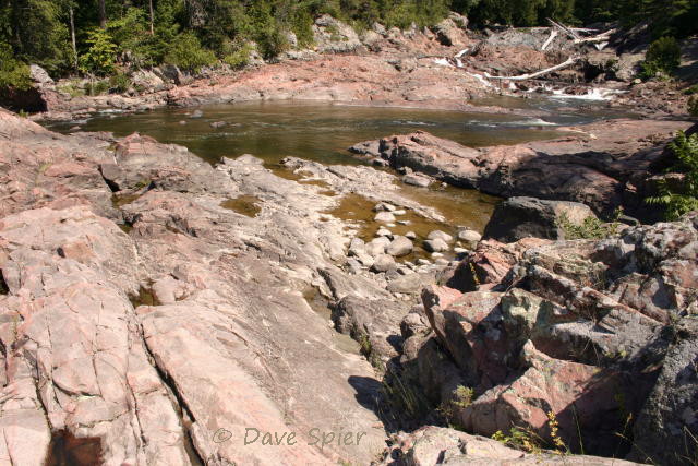
The Under-the-volcano nature trail begins on the finger of rock on the horizon at upper left. Hike around the beach and through some woods to reach it. – © Dave Spier
Markers explain the geologic features at each of the 11 stops along the trail. (I expected to find a trail guide on the internet, but so far have struck out, so I created one from the trail signs.) Station #1 presents an overview of the Under the Volcano Trail. “A billion years ago, this land bulged and shifted. Magma, molten rock, rose from deep within the earth to form a volcano. The rocks along this coastline bear the scars of a fiery birth. As you explore the rocky trail, imagine yourself walking back into time and into the magma chamber of an active volcano.”
Station #2, Coldwell Alkaline Complex, is a large-scale map of Lake Superior’s north shore around and west of Marathon, Ontario. Superimposed are generalized locations of the three main magma chambers. “The rocks along this trail are part of a unique feature called the Coldwell Alkaline Complex. Coldwell refers to the nearby historic fishing community of Port Coldwell. Alkaline refers to the high level of chemical elements such as sodium and potassium in the rock. By comparison, the surrounding rocks are rich in aluminum. This is the largest collection of alkaline rocks in North America. Complex refers to a group of related rocks. This complex includes several magma chambers or centers, which geologists have grouped into Centre 1, Centre 2 and Centre 3,” according to the interpretive sign. If Center 2 in Neys Park is any indication, each center contains several closely-related intrusions. The sign continues, “Under great heat and pressure, solid rock becomes molten rock or magma. When magma cools it forms igneous rock. Igneous comes from the Latin word [for] ‘fire.’ All the rocks of the Coldwell Alkaline Complex were born of fire.” Neys Provincial Park lies near the west edge of the Complex on the Coldwell peninsula. Port Coldwell is near the center of the three magma chambers (cauldrons) which together span roughly 15 miles. Each successive intrusion is relatively northwest of the previous but intertwining of the magmas confuses the issue.

The advancing glacier gouged deep grooves into the syenite during the last Ice Age. Cloudy, diffuse lighting makes them harder to see. (station 4) – © Dave Spier
Station #4, Written in Stone, depicts a cross-section of the shield cone at 1 billion years ago [bya], then 600 million years ago [mya] when it collapsed and plugged the chamber, then 300 mya as it eroded and finally the present with its nearly-flat surface. “Earth’s history is written in the shape of the land and in the size and composition of the tiny crystals within the rock. / The long grooves in the rock… trace the path of a glacier, a sheet of ice, two kilometres thick, that advanced over this spot from 100,000 to 10,000 years ago. Boulders, embedded in the base of the glacier, scratched rough grooves into the bedrock. Wind, rain and time have smoothed the edges of the glacier’s advance. Follow the grooves toward the water. Let each step take you back 25 million years. When you reach the next panel, one billion years will have passed and you will be under a smoldering volcano.”

nepheline syenite contains gray nepheline, light-pink feldspar, black amphibole and red natrolite (related to station 5) – © Dave Spier
Station #5, Nepheline Syenite. “You are standing on nepheline syenite, a rock formed in the magma chamber of the Coldwell Alkaline Complex. Syenite is a rare rock in the Earth’s crust. Nepheline syenite is even less common. Minerals visible within the syenite are Nepheline (gray, greasy, cloudy), Amphibole (black, shiny prisms), Natrolite (bright red, irregular patterns), and Alkali feldspar (pink, shiny rectangular). / Nepheline syenite is one type of rock. Rock is made up of various combinations of minerals which, in turn, are composed of a combination of elements. As the magma in the chamber slowly cooled, elements combined together and crystallized as minerals. …” Syenite is a pinkish rock similar to granite but lacking quartz. The exact color depends on weathering. It seems to vary from beige to deep pink, but freshly broken sections are textured with black, gray, light-pink and red (due to the four main minerals).

gabbro xenolith (bottom) in syenite (station 6) – © Dave Spier
Station #6, Ghosts in the Magma, explains two separate intrusions within Center 2. (The surrounding country rock in the diagram is not identified, however, and there is no scale on the sign.) “Numerous grey and bleached rock fragments are exposed in the syenite at your feet. Molten syenite intruded into an older, dark coloured rock. Fragments of the older rock, swallowed and partially absorbed by the magma, now lie like faint ghosts in the syenite. … The fragments are called xenoliths. ‘Xeno’ means foreign; ‘lith’ means rock. The ghosts are foreign rocks within the syenite.” Continuing along the trail will take you to the main body of gabbro, the dark rock that rose first and cooled before the syenite entered.

syenite vein in gabbro (station 7) – © Dave Spier
Station #7, Biotite Gabbro. “You have just crossed a contact between nepheline syenite and biotite gabbro. … The contact is dramatically exposed, showing the difference between the smooth, hard nepheline syenite and the pitted, soft biotite gabbro. Gabbro is the second major rock type in Centre 2 of the Coldwell Alkaline Complex. The soft nature of biotite mica, the main mineral of this gabbro causes the gabbro to erode faster than the nepheline syenite.” Gabbro is a dark igneous rock that cooled from magma rich in biotite (black) mica.

contact between pink syenite and gray lamprophyre* dike which has patches of lichens growing on top (station 8) – © Dave Spier
Station #8, Black Invaders. “The black line across the surface of the syenite is the top edge of a sheet-like intrusion, called a dyke. As the syenite cooled and hardened, it cracked. Magma invaded the narrow cracks, cooled quickly and crystallized as this black rock, called lamprophyre.* This was the last rock to form in Centre 2 of the Coldwell Alkaline Complex. The lamprophyre dyke contains white spots of the mineral calcite. While still molten, the calcite separated from the rest of the magma, much like oil separates from water. The rapid cooling of this magma ‘froze’ these calcite bubbles. A dyke, by definition, cross-cuts the structure of pre-existing rocks.”

textures and wavy patterns in the syenite result from turbulent magma currents in the chamber (related to station 9) – © Dave Spier
Station #9, Turbulence in the Magma. “The texture and wavy patterns of the syenite trace the stormy shifts of magma within the chamber walls. Layers of different minerals of varying grain sizes formed near the base of the magma chamber. Layers of minerals also crystallized along the cooler chamber walls. Earthquakes and tremors, common one billion years ago, dislodged unstable mineral layers of the chamber walls. The layers fractured and slumped into the molten centre. Turbulent magma currents disrupted the layers and slumped sections, creating the chaotic textures and patterns you see today.”
![joints [cracks] in the rock (station 10) - © Dave Spier](https://headingoutwithdave.wordpress.com/wp-content/uploads/2012/12/jointsneysppon_c2a9davespier_d020937blog.jpg?w=474&h=316)
joints [cracks] in the rock (station 10) – © Dave Spier
Station #10,
Joints.
“The long cracks beneath your feet are called joints. Follow the joints, (on the artist’s drawing)
as they change from narrow cracks in the syenite of the magma chamber to large gaps in the syenite exposed at the Earth’s surface. As the joints grow in size and number, the solid syenite bedrock is slowly reduced to boulders. / Weathering (today) – Near the surface, the freeze-thaw action of water widens the joints, allowing weathering of the exposed surfaces. With time, the once solid syenite will crumble into boulders, like the ones scattered around this area. / Uplift and Expansion (500 mya) – The forces of erosion gradually removed the rock above the syenite. With the reduction of overlying pressure, the syenite expanded. Existing joints widened and new joints formed. / Solidification of Magma (1 bya) – As magma in the chamber cooled and hardened, pressure from new magma, moving up from below, stretched and fractured the syenite, resulting in a regular pattern of joints.”
![another example of joints [cracks] in the rock (near station 10) - © Dave Spier](https://headingoutwithdave.wordpress.com/wp-content/uploads/2012/12/neysppon_c2a9davespier_d020933blog.jpg?w=474&h=316)
another example of joints [cracks] in the rock (near station 10) – © Dave Spier
Several notes: We did not make it to the eleventh marker. (There’s not enough room in this blog for all of the photos that took so long.) Finally, there’s no guarantee the plaques are still there if you visit; we haven’t been back for several years. If you have, please let us know. However, the hard bedrock will be in place for a long time. Erosion continues at an average rate of one centimeter every 5000 years. [one inch is 2.5 cm]

returning to the beach – © Dave Spier

A lamprophyre* dike cross-cuts the syenite in this outcrop on the beach. – © Dave Spier
The park visitor center has additional information, maps, and samples of the various rocks on display. From Center 1 (the largest, surrounding Marathon and extending north and northwest in what are now discontinuous units) there is an example of the ferroaugite (a.k.a. augite-amphibole) syenite and gabbro. This was later intruded in two stages by the Center 2 magma chamber (around Coldwell and Neys Park plus outlying units north and south). The initial biotite gabbro of Center 2 was subsequentlly invaded by pinkish nepheline syentite during a later stage of that chamber. Center 3 consists of granite, quartz-syenite, hybrid syenites (including ferro-edenite) and syenite-synodiorite.
______________________________
*lamprophyre – dike rock with dark minerals occuring as both phenocrysts (conspicuous crystals) and the fine-grained groundmass plus light minerals in the groundmass; essential components are biotite, hornblende, pyroxene and feldspar [from the Dictionary of Geological Terms, edited by Bates and Jackson for the American Geological Institute, Anchor Books, 1984]
______________________________
Corrections, comments and questions are always welcome at northeastnaturalist@yahoo.com or connect through my Facebook photo page, my personal page, and The Northeast Naturalist page. Other outdoor topics (mostly nature and birding) can be found on the parallel blogs northeast naturalist and Adirondack naturalist.